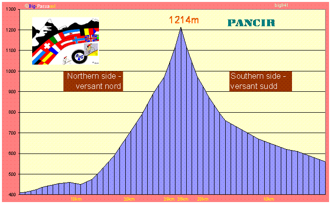
841 Pancíř
Location:
Mountain
range: umava
Law: Asphalt road and MTB trail are open for bicycles
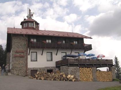
Top: Mountain chalet (chata Pancíř), View tower, Cable car, Altitude mark
Nature:
Forested
area
Nature
reserve Pramenitě (E part of mountain)
National park umava (E part of
mountain)
Roads:
Asphalt (N, S) last
MTB trail (N)
Touristic criteria:
Very popular winter sport center
Frequently visited in summer (cycling and hiking)
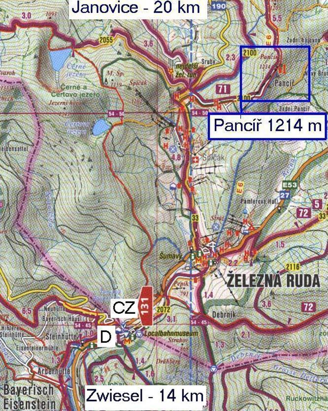
Accessions:
N asphalt, 804
m , 30
km , max 14%
S asphalt, 664
m , 26
km , max 14 %
N MTB trail (road bikes
impossible)
Detailed map:
Overall opinion: 4/5
Nature: 5/5
Difficulty: 3/5
Tourist criteria: 4/5
General comments:
On the
Long valley section (from both
sides N a and S) can be easily avoided by frequently
operated train line which gain altitude zigzagging from one side of narrow
valley to another but you shouldnt go that. Cycling this pre-climb is fine
because the countryside seems to be very scenic and road rises gently avoiding
brutal gradients. The real climbs starts after reaching altitude of small pass
and shifting to small asphalt road (car restricted) cutting through mountain
forest. Altimeter shows sometimes values more than 10%, once 14%.
Alternative MTB trail is
described as a superb, one of the best in this country. Long
views, good forest roads and excellent traction on lower fast winding section.
Suspension fork is not obligatory but appropriate tires are more than
recommended, especially in May where there is a lot of water from melting snow.
Starting in Janovice you will follow only few
kilometers of asphalt road and start forested mountain adventure soon
Photo:
http://www.jiznicechy.org/cz/index.php?path=prir/pancir.htm