 BIG Nr 183 in the night
KATZENBUCKEL,
the german Vulcan - le volcan allemand
BIG Nr 183 in the night
Traduction / translation : La bosse du chat - The cat's hill 
 Just like the Puy-de-Dôme, the Katzenbuckel is a closed vulcan. To reach its top gives you one BIG more. Just comme le Puy-de-Dôme, le Katzenbuckel est un volcan éteint. Rallier son sommet vous donne un BIG supplémentaire.
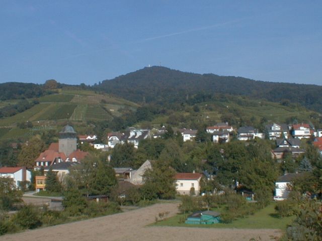 Le dôme est couvert d'une épaisse forêt et les villages s'accroche à cette colline de l'ancien feu. The dome is covered with a deep forest and the villages take place on the sides of this old Hill of Fire.
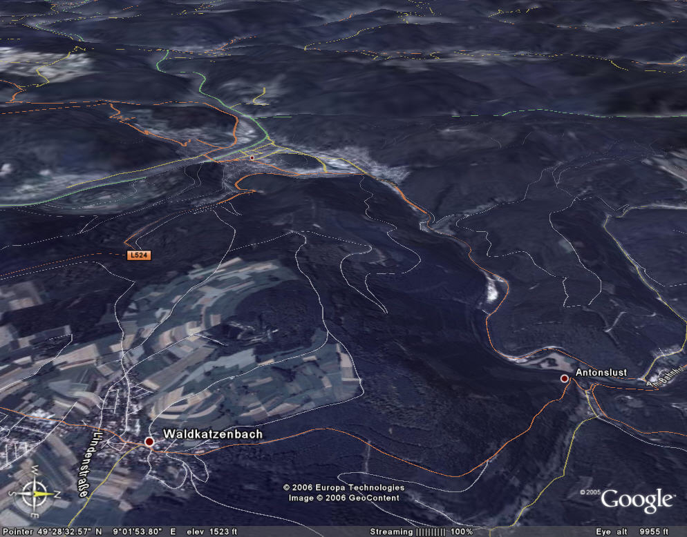
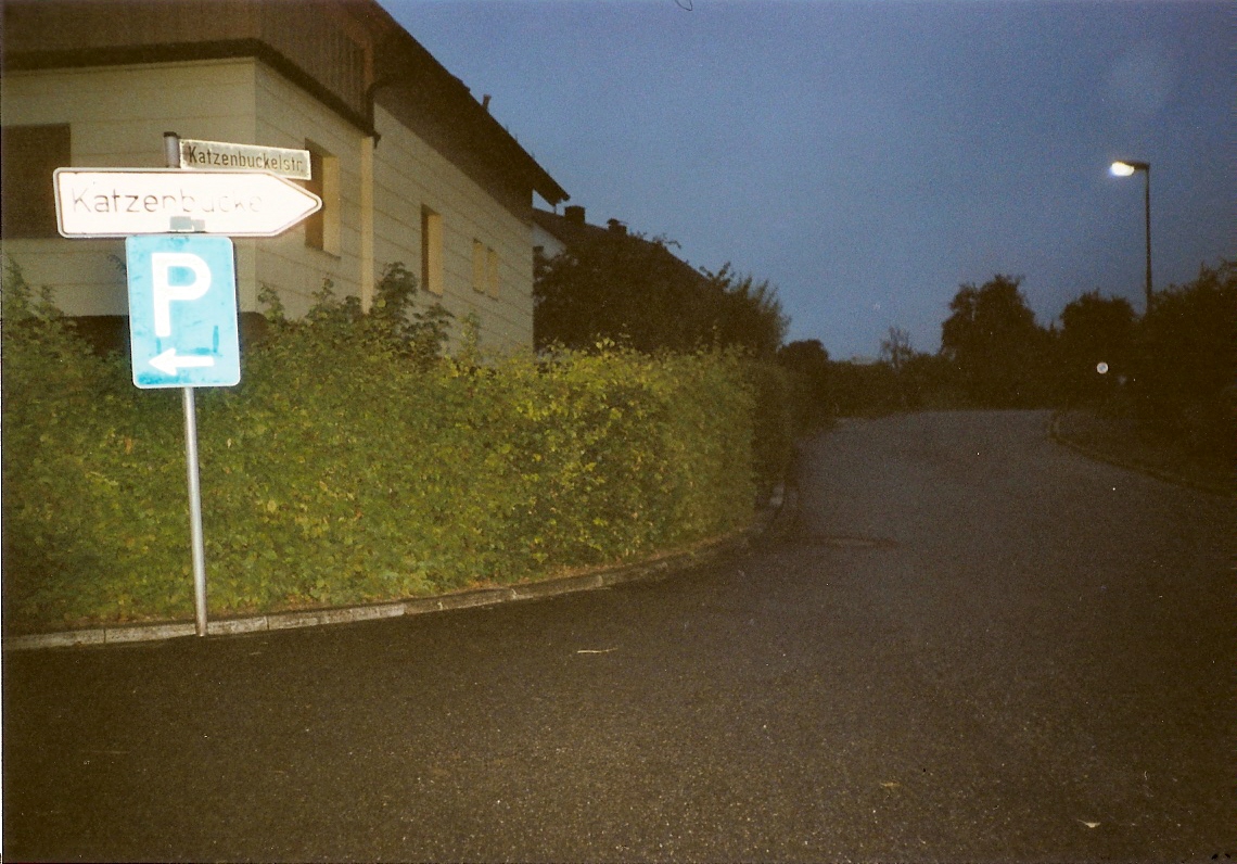
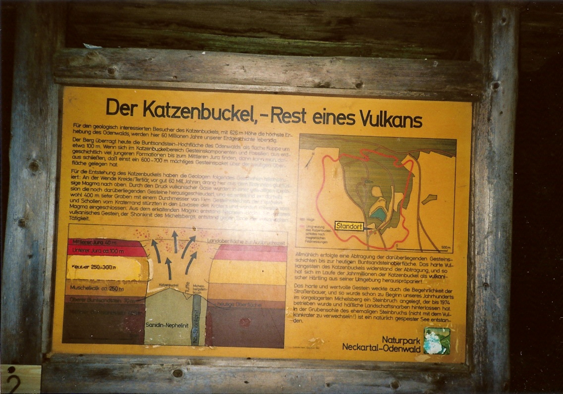
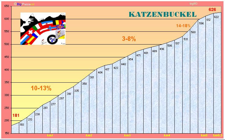
Coming from the right side of the map, from Ebersbach, following the way to Amorbach and after in Gaismühle, the way to Waldbrunn, you hurt a steep wall immediately at Antonslust (13% written on 2 road-signs in the downhill way) . After two infernal kilometers, it's less steep and you come in Waldkatzenbach. In the center of the village, turn to the right following the direction "Katzenbuckel". 500m further, turn to the right and take the Katzenbuckelstrasse. The gradients go another time a little up and you reach an hostel-restaurant called "Turmschenke", with flags in the entrance, a car-park on the right with the explanations about the vulcan (see here up) and the lake Katzenbuckelsee. This hostel is on the map just three centimeters up the name "Waldkatzenbach" and the line of the road seems to be ended. But in fact, you can follow with a steep section on gravelled road to the top, not so far. The view up is magnificent with a 360° landscape's overview.
Venant de la droite de la carte, depuis Ebersbach en suivant la direction Amorbacj, puis à Gaismühle, en suivant la direction Waldbrunn, vous vous heurtez à un mur raidillon absolu de 2 kilomètres à Antonslust (13% indiqué deux fois dans le sens de la descente sur un panneau routier). Après ces deux bornes infernales, vous avez une portion moins pentue en pénétrant dans le village de Waldkatzenbach. Au centre du village, sivre la direction Katzenbuckel et tourner à droite. 500m plus loin, de nouveau à droite, vous empruntez la Katzenbuckelstrasse où les pourcentages réaugmentent un tout petit peu pour vous amener à l'auberge-restaurant du nom de Turmschenke, avec à droite un parking, la pancarte d'explication (voir photo ci-dessus) et un lac du nom de Katzenbuckelsee. L'hôtel est sur la carte google juste trois centimètres au-dessus du nom Waldkatzenbach et la route semble s'y arrêter. En fait, elle se prolonge par un muletier très pentu mais assez court qui vous mène à la tour du sommet avec une vue panoramique magnifique à 360°.
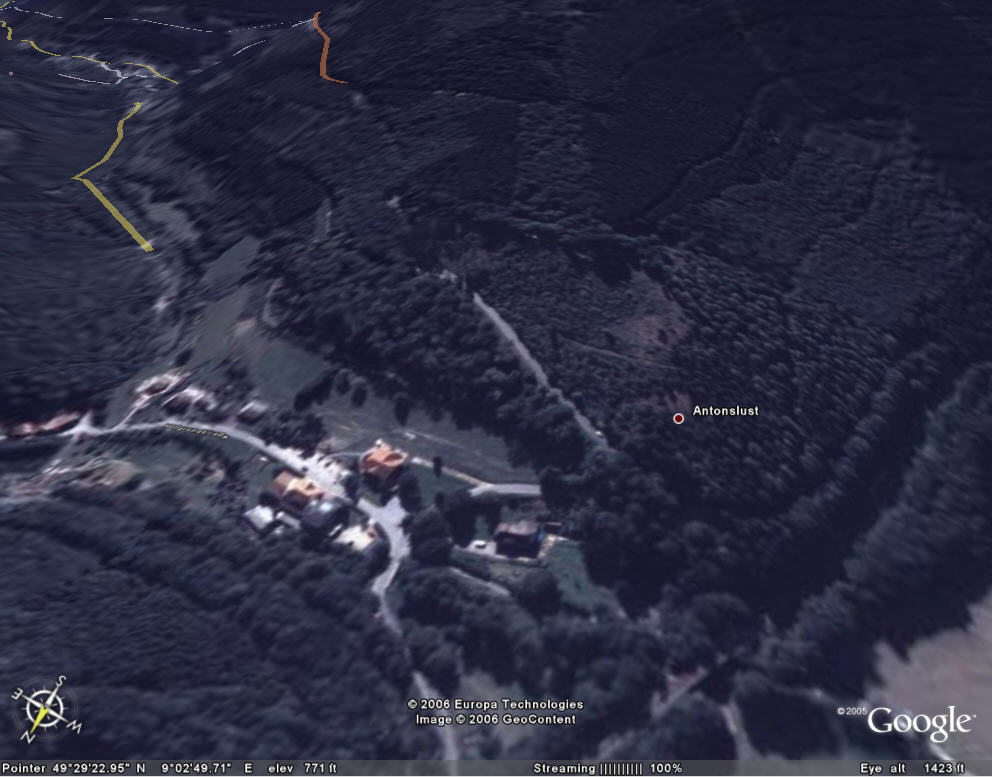
One can see very well, near Antonslust, the straight line with 13% going to the sky until it reaches the orange road.
On peut voir facilement, près d'Antonslust, la ligne droite avec 13%, filant vers le ciel et tentant de rejoindre la route orange
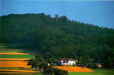 The white house is the hostel-restaurant at the end of the surfaced road, up : the tower.
La maison blanche est l'hôtel-restaurant à la fin de la section revêtue. En haut : la tour.
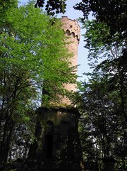 The tower - La tour - KATZENBUCKEL TURM